Future use of land at Shotwick Park
Cheshire West and Chester Council is working in partnership with Saughall and Shotwick Park Parish Council and The Mersey Forest following a decision in November 2024, for the Council to retain land at Shotwick Park.
Details of the decision made at the November cabinet meeting can be viewed on our website.
The Council is now exploring ways to help ensure that the site reflects the needs and aspirations of local people and protects the historic and ecological assets of the site, whilst attracting enough external funding, grants and other income to sustain the management of this land into the future.
We’re really keen to understand what people currently value in Shotwick Park and how they use it, to help inform future plans for the site. We’d also like to hear your views and ideas for how the site could be enhanced or positively managed into the future, for the benefit of local people, nature and the climate.
Information about the proposed project and details on how people can share their views about the site is available on the Council’s Participate Now site (see link below). Details about the engagement has also been shared through the Parish Council’s communication channels.
Map of Shotwick Park
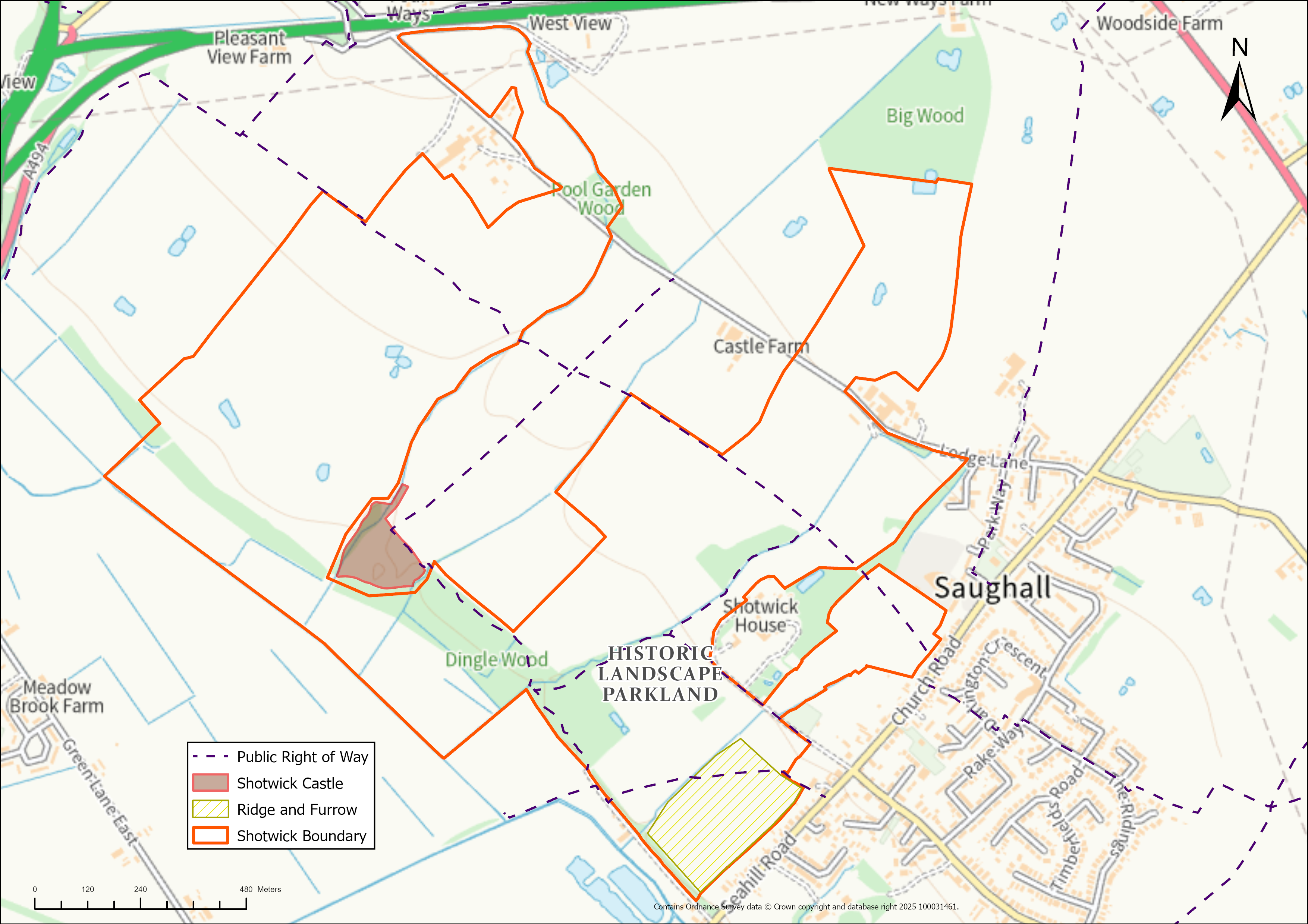

Shotwick Park is an area of 150 hectares of land comprising of pasture, woodland, arable land and an area of historic parkland. The land is located in Saughall, to the north-west of Seahill Road and Church Road and south of the A494. There is land either side of Lodge Lane, with the majority lying south of the lane. It does not include a section of land in the middle of this area, where the Shotwick Castle ancient monument is located.
For any further queries, please email via: